Trek to Korigad Fort near Aamby valley, Lonavala
This is a great place to go for a one day trip from either Mumbai or Pune due to the following reasons
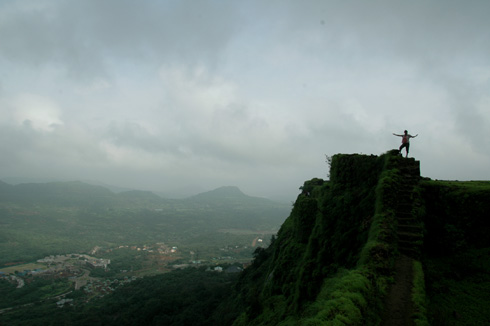
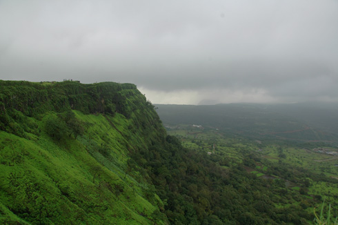
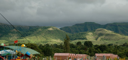
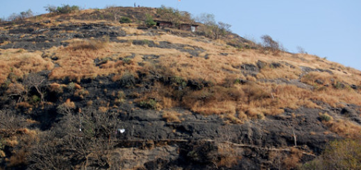
- The Location: A plateau with unhindered views on all sides with a view of many other forts and dams
- Drive to the location: Cross all of Lonavala’s famous view points and get to the fort through some wonderful roads OR do some adventurous driving and go through remote backroads from Mulshi
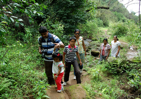
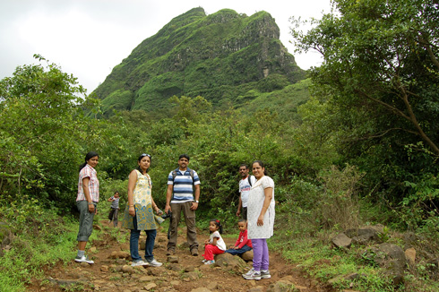
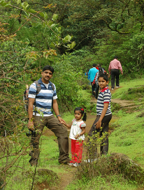
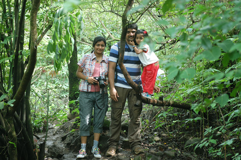
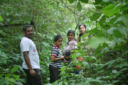
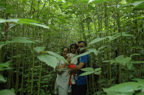
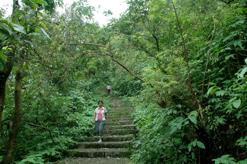
- The Trek: An easy trek of around an hour. It took us a little more with two 3 yr old kids, drink breaks and lot of photo breaks. The trek has it all – open path, an optional shortcut through a dense jungle and a flight of stairs at the end
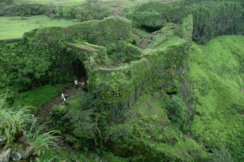
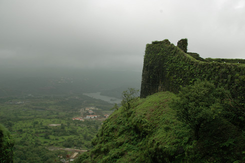
- The Fort: Though nothing much remains of the fort, the walls of the fort are intact and you can walk on the wall for the entire circumference of around 2 km (we didn’t, though)
How to go to Korigad fort (also known as Koraigad fort) from Pune: Korigad fort is right next to the Aamby valley city and very close to Tung Fort. You have to cross Lonavala and then keep driving towards Aamby valley. The base village for this fort is Peth-Shahpur. If you start early, you can stopover at the various Lonavala points like Bushi Dam, Lions Point and the shivling peak. Lonavala traffic is very bad , at least on the one main road. So, better to go into Lonavala pretty early in the day. See at the bottom of this post for an alternative route/round trip
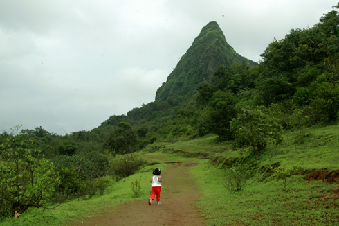
Once you drive down the ghat section after the lions point and keep going for another 15-20 minutes, the hill of korigad fort should appear on your left. There is nothing else this tall in this area, so you shouldn’t miss it. There is an open area just below the hill for parking. It is just another open area, but there are touts there who demand money (and give receipts too!) saying that it is the official parking for Korigad fort. They charge Rs.20 for a bike and Rs.50 for a car. I probably could park on the middle of M.G.Road for a cheaper amount!/p>
If you want to save few hundred metres off the trek, then drive on the road to the left (just before the hill) and park near a temple (not sure abt the parking place). A path from this temple directly joins the trail. Along the normal route, you start from the parking lot, go towards the tower and then continue on. The initial path can become very slippery in case of rain and it is the path through the water flows and is very muddy. But, not something to worry about.
The path goes around the back of the hill and then your start climbing. So, the trail is not visible from the road or the parking lot. Once you cross the initial stretch, the path turns a sharp right and you start to go towards the back of the hill parallel to the bottom. After some distance, you start to see small lamp posts. These have been erected by the Sahara group to aid trekkers , as Korigad is a popular night trekking destination. When you see the first such lamp post to your right. you have two options. You can continue straight on which will take you amidst few bungalows and then take a u-turn to go up or you can just start climbing the hill right at the base of the lamp posts. It looks steep, but is not. This short-cut is an enjoyabale 10 min climb through some dense lush growth – almost resembling a rain forest.
Then come the stairs. Initially, they start off pretty ok, but the last stretch is a bit steep. But the last stretch is not too long. Also, there is a viewpoint with a big resting area. Once you cross the stairs and pass through the main darawaza, you are on top of the hill. Once you are on the stairs, you get a good view of the development in Aaamby valley city.


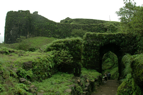
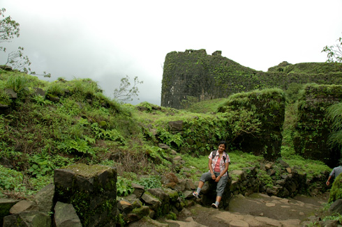
The main darwaza covered in moss (during monsoons) is a great sight.There were also lot of monkeys around this point.

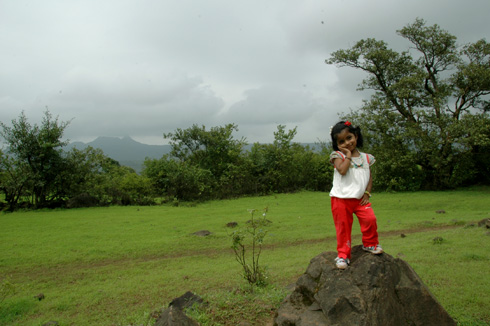
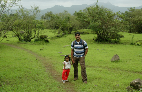
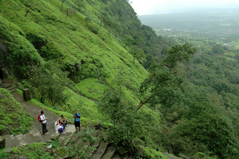
Once on top of the plateau, if you have the interest, you can spend hours enjoying the view on all sides. The fort walls are intact and you can walk all along the wall. The top also has two fresh water ponds (not safe for swimming, as there have been few incidents here) and couple of temples. There are also many intact cannons on top.
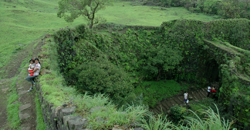
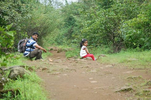
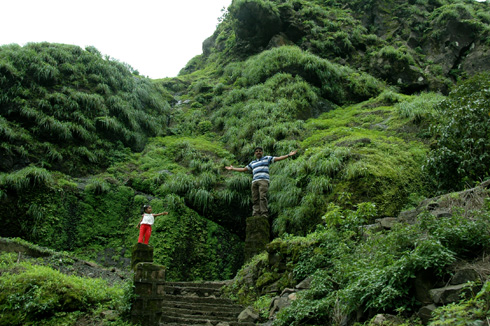
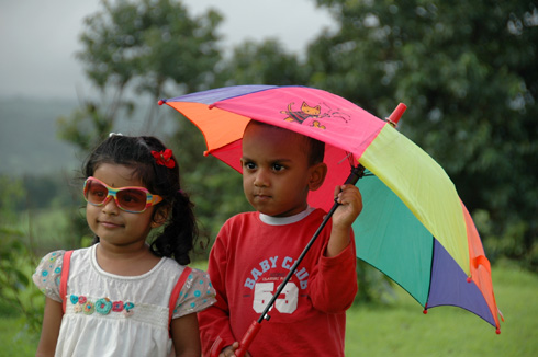
The way down (same as the way going up) was fast and easy and took less than an hour. It also rained when we were coming down and it was fun trying to fit all of us and two kids into the 2 kids umbrellas we carried with us! All of us enjoyed the trek including the kids, as can be seen in this photo (from a photo session) taken after the trek.
There is another route to reach Korigad from Pune. You can either go through this route or make it a round trip by returning on this. But this route is remote and not advisable late into the evening. If you have been to Mulshi or Tamhini Ghat , you would have come to a fork before Mulshi and you would have taken the left. The road on the right goes to Ghusalkhamb, which is actually the base village for Tung fort. If you go to Korigad from Lonavala, you will pass this village before you reach Peth-Shahpur. But, i have read on many forums that the road condition is 50-50, whatever that means! A third route exists, that from beyond Mulshi. After crossing Mulshi and towards Tamhini, there is a road sign to the right marked as Lonavala. This goes through lot of interior roads and reaches Korigad fort and then onto lonavala. I have seen this road being mentioned only on biker forums and the reviews says this unspoilt road is amazing during the monsoons. Drop in a comment if you have been on any of these routes.


Hi guys,
We are planning to go to korigad this Saturday. I heard that now a days police does not allow buses from bhushi dam road. Can u please help me coz we r 8 families and we have small kids ranging from 4-8 yrs. so don’t want any fiasco at last moment.
Regards,
Prasad
yes, monsoon in lonavala is extremely crowded. Rather than go through the lonaval route (which is the easiest), you can try to reach to paud (from the pune side). But if you are in lonavala pretty early in the morning, you cn escape the crowds.
Hi Rajaram,
We are planning trek to Korigad 3rd Aug 2013. from one of my friend I came to know that there will be heavy traffic on route from Lonavala to Peth Shahapur. Is it true?
Plz reply. SO that I can book train tickets from Mumbai to Lonavala and back.
Thanks in advance.
Yuvraj
awsome written with beautiful photographs…
thankss for sharing 🙂 🙂
Thanks for sharing detail information about route & photos shared.
Regards.
Paresh Tillu
had gone to this fort several times real forest of lonavala is ahead to this n is surrounded by forts like Ghangad, Tail Bailla.
thanks for the lovely description Neeraj.
This route has been on my radar for quite some time. Wanted to do the loop around mulshi.
Go through the one you have mentioned and come back on the other side of mulshi and join near Tamhini.
I am unfortunate to find this page today only. We visited the fort this weekend.
We were 5 adults in a Swift. I took the Dattawadi road from Mulshi (Turned right on the fork just before Mulshi). Dattawadi road is pretty good, except for a small stretch, which was unpaved due to the some reason. Here we ran the real risk of the car getting stuck in the muck. The view is very scenic, and you will not find a single soul for many km, except for some wildlife (squirrels, monkeys and some beautiful birds). If you roll down the car windows and switch off the music system, you can hear the water gushing and the birds chirping (I could hear many new types of chirps) for many km.
You should keep following the Dattawadi road, without turning anywhere – you will finally end up at the edge of Amby valley after 3 hours. Keep going straight (another 10-15 min) till you land up at a T junction where a wide and completely paved road will greet you. (There is a small roadside eatery on the left side at this junction, which serves tea, coffee, biscuits and hot bhajiyas for the tired souls). Turn left at this junction, Koraigad is 8 km from here.
Fine Print:
1. The 3 hours mentioned above includes a small lunch break and 3 short breaks for clicking pictures (Sorry, but I didn’t note the meter readings, so cannot specify the exact distance).
2. It is strongly recommended to carry your our own lunch, snacks and water if you are taking this route. If you cannot do that, there is a “Kamats” restaurant (www.vithalkamats.com) between Paud and Mulshi fork, where you can grab a bite before you begin the adventure.
3. If you feel you are lost, the best guide about the route is the ST bus driver – they do not stop for you, and once I had to block his way to ask for directions.
Dear Sir,
Please let us know the food facility near by.
Its an awsome place… I had 1 of the best moments of my life over there… Thanks Man… and your site is also really nice..Nice 1 for travelling freaks,like me and many more…